Jeff Sisson of I Like Nice Things has a new project called The Bodega List. His goal is simple: to create a homepage for every single bodega in New York City, most of which currently exist only in the physical world.

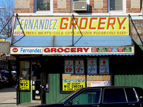
IMAGE: Bodega in Sunset Park, by Flickr user gkjarvis.
His methodology relies on using crowd-sourced bodega verification to sort through a longer list of businesses with a permit to sell alcohol for consumption off-site:
Bodegas on the bodega list come from off-premise liquor license listings on the New York State Liquor Authority website. Bodega images, locations, and names are gleaned by humans using the “IS THIS A BODEGA?” tool. Once a bodega has been verified, it appears on the list and on the red dot map, and it is given a homepage.
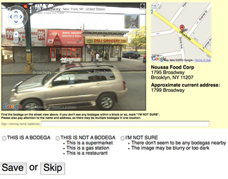
As it turns out, volunteer bodega spotters need never set foot in New York, and can work from the comfort of their homes using Google Street View. Each click on the “Is This A Bodega?” button serves up a random business address from the list, along with a 360º view of the corresponding location. At the bottom of the page are three options: “This is a bodega,” “This is not a bodega,” or “I’m not sure,” plus an optional box to record the name on the awning (which is not always the same as the registered business). Answer, hit save, and move on to the next bodega—it’s strangely addictive.

IMAGE: Screen grab from The Bodega List, showing the bodega verification process.
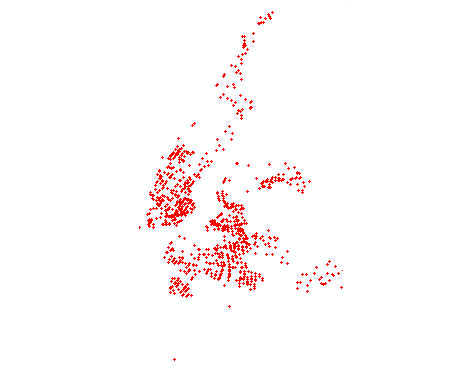
Aside from the mechanically rewarding verification process, there are a couple of interesting aspects to the project. Firstly, each verified bodega is marked by a red dot on a Sisson’s map, which—when finished—will provide a fascinating visual representation of bodega density and distribution across the city. Will there be correlations with maps of diabetes and health outcomes, household income, demographics, land use patterns, or population density? How might bodega locations shift over time?
After all, if the spread of cupcake shops can be used to predict urban gentrification, what information might a time-lapse map of bodega locations yield?

IMAGE: Each red dot represents the location of a verified bodega on Jeff Sisson’s Bodega List.
Meanwhile, because the “Is This A Bodega?” button is randomised, the project provides an eclectic, non-linear tour of the city’s streetscapes as seen from the perspective of local bodegas. The idea that someone in Sydney or New Delhi could be sitting in front of their laptop, leaping from the West Village to the South Bronx and back to Murray Hill, is incredible.
Many New York City bodegas form a hub in their communities, adding services and stocking goods to respond to micro-local needs and preferences, while functioning as an informal, inter-generational meeting space—which means that the New York experienced through The Bodega List is a kind of curated view of the everyday, from across the very different lives of the city’s 8.3 million residents.

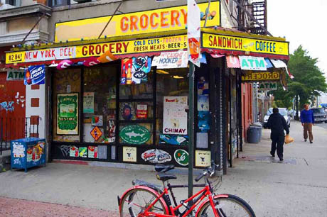
IMAGE: Bodega in Brooklyn, via Flickr user Paul Kostro.
I’m not sure that New York City’s bodegas each need a homepage, although this website makes a compelling case for their online representation in terms of building recognition for bodegas as an under-appreciated urban resource, worthy of historic preservation. Still, for the random virtual bodega tour and the resulting map, Sisson’s Bodega List is well worth checking out.
[NOTE: For more on New York City’s bodegas, including the logic behind their inventories, locations, and distibution, check out an earlier post on Edible Geography: Digest | Feeding the Bronx. Thanks to @farmingconcrete for the link.]
