
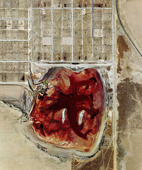
IMAGE: “Coronado Feeders, Dalhart, Texas” (2013), Mishka Henner (archival pigment print, 102x122cm).
British photographer Mishka Henner’s most recent work shows the astonishing and terrible beauty of two of Texas’s most valuable landscapes — its feedlots and its oilfields — from above.
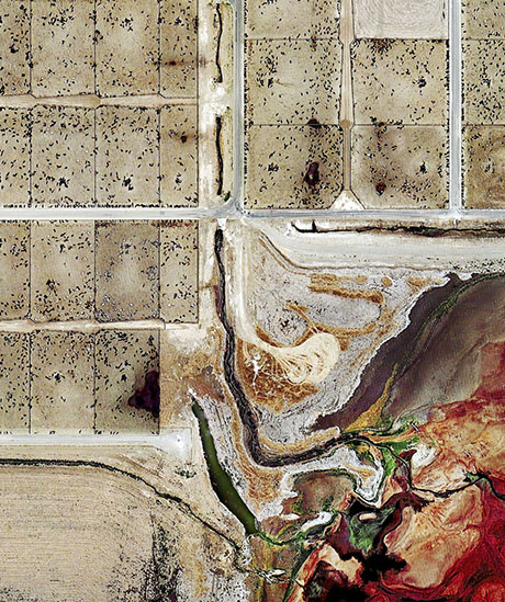
IMAGE: “Coronado Feeders, Dalhart, Texas” (2013), Mishka Henner (detail).
Even more astonishingly, the aerial imagery from which these works were composed is entirely shot by machine. Henner compiled hundreds of publicly available satellite photographs of his chosen sites, knitting them seamlessly together to create ultra-high definition images that, according to those lucky enough to have seen them in person, look, at first glance, like Abstract Expressionist paintings.
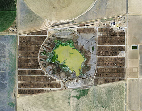
IMAGE: “Tascosa Feedlot, Texas” (2013), Mishka Henner (archival pigment print, 102x102cm).
Ninety-seven percent of the beef consumed in the United States will have been “finished” on a feedlot: a vast and odoriferous empire of pens and troughs where up to 100,000 steers at a time spend the last three to six months of their short (12 to 18-month) lives gaining up to 4 pounds a day on a diet of corn, protein supplements, and antibiotics.
Digestion at such an industrial scale produces equally colossal amounts of manure. In Henner’s images, the swirling blood red and bilious greens of the feedlot waste lagoons threatens to overwhelm the ant-like cattle clustered on their desaturated brown and tan squares.
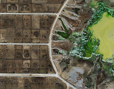
IMAGE: “Tascosa Feedlot, Texas” (2013), Mishka Henner (detail).
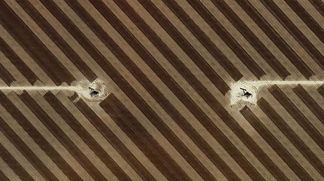
IMAGE: “San Andres Oil Field, Hockley County, Texas” (2013), Mishka Henner (detail).
Of course, as Michael Pollan eloquently notes in his account of one steer’s journey from ranch to steak, the feedlot and the oilfield are intimately connected, in a way that extends beyond their shared status as systems of maximal resource extraction:
The feedlot’s ecosystem, I could see, revolves around corn. But its food chain doesn’t end there, because the corn itself grows somewhere else, where it is implicated in a whole other set of ecological relationships. Growing the vast quantities of corn used to feed livestock in this country takes vast quantities of chemical fertilizer, which in turn takes vast quantities of oil—1.2 gallons for every bushel. So the modern feedlot is really a city floating on a sea of oil.
IMAGE: Installation view, Mishka Henner, Precious Commodities, Open Eye Gallery, 2013.
On display at Liverpool’s Open Eye Gallery earlier this year, Henner’s oilfields and feedlots were installed alongside a set of geological maps, setting up a clever visual connection between the cartographic representation of subterranean resources and the similarly abstracted quality of the surfaces that their extraction and utilisation produces.
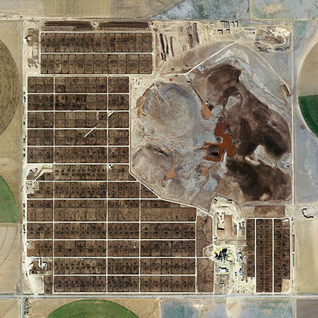
IMAGE: “Producers Feedlot, Texas” (2013), Mishka Henner (archival pigment print, 102x102cm).
In some ways, Henner’s feedlots remind me of the work of David Maisel, who has also made troublingly gorgeous photographs from the striking patterns and colors of toxic landscapes viewed from above.
However, Henner’s work is not only commenting on the landscape, but also the act of photography itself: rather than taking photographs to document something in the world, he is adding discrimination and perspective — the art of a photographer — to make images from the flood of documentation assembled by machines.
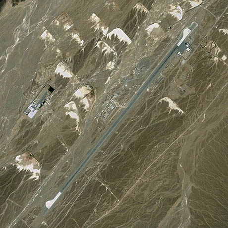
IMAGE: “Central Intelligence Agency Predator Drone Launch Site, Shamsi Airfield, Pakistan, 27°50’52”N 65°9’40”E,” Mishka Henner, in Fifty-One US Military Outposts, 2010.
As Henner’s earlier work, collecting satellite images of U.S. and Dutch military sites, demonstrates, the Internet is already home to plenty of powerful, subversive photography that documents otherwise off-limits landscapes. Nothing, no matter how remote or restricted in access, is truly secret anymore — we’re just not, for the most part, looking hard enough at what’s already out there.
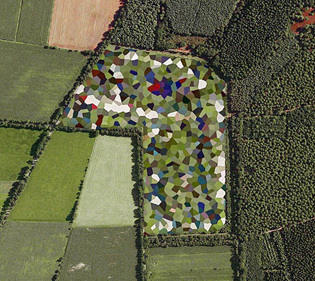
IMAGE: “Staphorst Ammunition Depot,” Mishka Henner, in Dutch Landscapes, 2011.
Of course, Google Earth satellite imagery of many sensitive sites has been obscured by pixellation — or, in the case of the Dutch, by multi-coloured polygons — at the request of the governments concerned. Still, in direct opposition to their intended purpose, these interventions act as signposts, revealing the location and importance of ammunition depots, artillery ranges, and military bases.
IMAGE: “Producers Feedlot, Texas” (2013), Mishka Henner (detail).
In an era of “ag-gag” laws, in which industrial-scale meat producers have persuaded several compliant state legislatures to make the act of documenting animal facilities with defamatory intent a crime, Earth’s manmade constellation of satellites may yet provide the only documentation of the landscapes that agri-business would rather keep hidden. Redefining the act of photography is not just a philosophical conceit in this instance; it is a necessary progression to continue the photographer’s work of helping us see the world.
Discovered via @FolkertGorter.